The CCC® is one of the flagship races of UTMB® Mont-Blanc. The course follows a big chunk of the second half of the UTMB®, with a few twists of its own. If you dream of running the UTMB® one day, the CCC is definitely a race to put on your calendar. With 100 kilometers and 6,000 meters of elevation gain, the Courmayeur – Champex – Chamonix start takes place right in the center of Courmayeur, Italy. Here are our tips to help you manage your CCC® as well as possible.
CCC: A long, tough first climb out of Courmayeur
The UTMB® course passes through Courmayeur and the Bertone refuge. But even though the CCC® starts in Courmayeur, it doesn’t go straight to Bertone.
The start in Courmayeur (around 1,200 m above sea level) has a unique vibe in the village, with Vangelis’ “Conquest of Paradise” playing in the background. You get about 1 km through the center of Courmayeur on flat ground to settle in, before the gradient slowly ramps up. The route is wide at first. Even when you hit the first trails, it still stays wide, on a 4×4 track.
The UTMB® climbs left toward the Bertone refuge at km 3, while the CCC® stays on the 4×4 track until km 4.5 at the hamlet of Tsapy. Make the most of these first 4.5 km to find your rhythm—because the singletrack begins right after the hamlet. After that, passing becomes really difficult on the narrow “single” trail all the way to Tête de la Tronche at km 9.
Finding your rhythm means neither too fast nor too slow… because you’re looking at 1,000 m of elevation gain in 4.5 km—basically a vertical kilometer (VK), with a slight breather halfway up. So don’t start too slow, or you risk getting stuck behind a group that’s moving at a crawl. But don’t start too fast either: not only will you block runners behind you, you’ll also pay for it later—there are still 90+ km to go…
The key word on the climb to Tête de la Tronche (2,584 m) is caution! If you brought poles, you’ll want them out as soon as the singletrack begins. Save your quads as much as you can.

CCC: Dropping from Tête de la Tronche into Val Ferret
Once you finally reach the top of the endless Tête de la Tronche, it’s time to drop down toward the Bertone refuge. You can start running again at a moderate pace. On the CCC, Bertone is at km 13. If the weather is clear, take a moment to look up: Mont Blanc rises majestically right in front of you, along with the Grandes Jorasses!
Then you’ve got 12 km of balcony trail facing Mont Blanc—a roller-coaster section with a constant string of little bumps, mostly runnable. Try to stay as relaxed as possible; this isn’t the place to crank up the intensity. Next comes a short but fairly steep descent down to Arnouvaz at km 25.
Crossing Grand Col Ferret
You’re reaching the end of Val Ferret—at least the lower part. Now it’s time to get ready to say Ciao to Italy and climb roughly 750 m up to Grand Col Ferret (2,537 m). Often windy, it can feel very different depending on how you’re doing. If you’ve been smart so far, it’s steep but steady, and it goes by way faster than Tête de la Tronche! If you’ve already pushed too hard, you’ll feel it in your quads.
You reach the border between Italy and Switzerland—less than 5 km as the crow flies from Mont Dolent, where France, Italy, and Switzerland meet.

Welcome to Switzerland
Switzerland knows how to welcome you! With the villages you’ll pass through later, but also with a first smooth descent that lasts almost 20 km. Just be careful: it can be a trap 😉 It’s easy to push hard on the way down to La Fouly. Some runners say this is where you can finally “let loose.”
In my opinion, that’s a mistake. You still need to protect your quads—staying in an easy aerobic effort (or just slightly above). The descent is long, and many runners overdo it and then have to walk for a long time to recover after La Fouly. Yet the section from La Fouly to the bottom of the Champex-Lac climb is very runnable if you haven’t made any bad choices. The few seconds gained early in the descent can end up costing you several minutes later—walking on flat terrain.
La Fouly is a typical village, with an aid station and super welcoming volunteers. The paths along the Dranse river are really pleasant and bring back some shade under the trees. You’re getting close to the climb up to Champex-Lac.
The climb up to Champex-Lac
The climb to Champex-Lac is steep but fairly short (around 400 m of elevation gain). After a long runnable stretch, it hits the quads hard. That’s when you’ll want to shorten your stride and use your poles to keep your rhythm. At the top, you reach the stunning Champex Lake.
The first runners come through in the early afternoon, but for many, this climb happens at night. In Champex, at km 53, there’s an aid station. People often say the CCC really starts now! Even though, of course, your legs aren’t exactly fresh anymore.
Don’t hesitate to take a short break so you can get going again properly. From here, you’ve basically got a sequence of three climb–descent blocks, each with 700 to 800 m of elevation change: Bovine, Catogne, and Tête au Vent.
The Bovine, Catogne, and Tête au Vent sequence
Leaving Champex, the path along the lake is flat, and the section up to the base of the Bovine climb is generally smooth and runnable.
Bovine climb
From here on, you’ll be working with legs that are no longer fresh—so don’t overthink it. The Bovine climb has a slight flatter section before a steep part that’s intense but thankfully not too long. The descent into Trient is fairly technical, and runners going through at night will need to watch out for roots. You’ll be glad you practiced downhill running in training!
Catogne climb
There’s another aid station in Trient, a small Swiss village known for its pink church. You’re at km 70, and the next climb is very steep again. Luckily, the gradient eases near the end, and once you crest Catogne, the descent into Vallorcine lets you move quickly: it starts on a narrow trail, then a wide track toward the ski lifts, and finishes with a more technical section through the forest before you reach Vallorcine.
Vallorcine is the last “full” aid station. There’s just under 20 km left, and if you’re feeling good, you know you’ll make it to the finish. If you’re struggling, set off carefully—there’s a bit over 3 km of false flat uphill to Col des Montets.
The Tête au Vent – Flégère climb
At Col des Montets, you can see the wall rising up for the final climb! At night (typically for runners placed between 50th and 1000th), it almost feels poetic. You can see a trail of headlamps like fireflies moving above you. This climb is made up of stone blocks, almost like steps.
The Tête au Vent climb is legendary for CCC and UTMB runners. For those doing it at night, the challenge is even tougher because once you reach Tête au Vent, the trail stays very technical all the way to Flégère, with lots of rocks. Runners in the top 50—and those in the back half of the field—get treated to a spectacular view over the entire Mont-Blanc range!
Finishing the CCC in Chamonix
Once you reach Flégère—where there’s a light aid station, mostly liquids—you’re almost there! The descent into Chamonix is done with whatever you have left. If you’re exhausted or dealing with pain, you’ll manage it as best you can. If you’re feeling good, you can throw your last strength into the fight on this descent! It has plenty of switchbacks but it’s quite runnable.
When you cross the Arve river, all that’s left is to enjoy the final kilometer through the streets of Chamonix. You might already be picturing the finish arch… the cheers in the streets. We’ll let you discover the finish-line atmosphere and the emotion of crossing the line 😉

Gear for the CCC
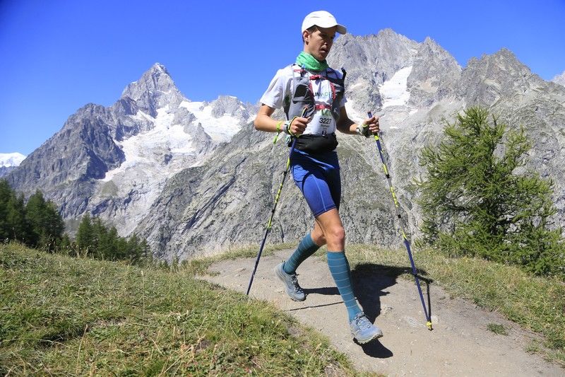
For the CCC, there’s a mandatory gear list. Take the time to review it carefully. Pay extra attention if the weather is tough (rain, snow, cold, wind). And of course, don’t forget your headlamp if you’ll be running a big part of the race at night.
On nutrition: aid stations are generally placed every 10 to 15 km, which makes it easier to stay well hydrated. You can also carry purées, bars, or gels to top up between aid stations. We recommend planning your nutrition strategy for your ultra trail in advance.
For me, CCC 2021 is an unforgettable memory: breathtaking scenery, very mild weather (almost a bit warm), and solid race management to finish in 15:21 (147th).
All that’s left is to wish you a great race! And if you’re reading this early enough, feel free to download RunMotion Coach, the official coach of UTMB® Mont-Blanc, to get ready 😉
Image credits: official UTMB® Mont-Blanc website